 City postcard
Porterville
Sierra Nevada's backdoor — small-town charm meets giant sequoia country in California's Central Valley.
Sierra Nevada's backdoor — small-town charm meets giant sequoia country in California's Central Valley.
Porterville is a laid-back city of roughly 63,000 nestled in the foothills of the Sierra Nevada on the eastern edge of California's San Joaquin Valley. Serving as the primary gateway to Sequoia National Forest, Giant Sequoia National Monument, and Kings Canyon National Park, it pairs old-town downtown character — murals, boutiques, and the beloved Spring Festival — with outstanding outdoor recreation at Lake Success and the surrounding mountains. The climate brings sun even when valley fog blankets neighbors, and an agricultural heritage rooted in citrus, olives, and dairy gives the region a distinct local flavor.
City postcardSierra Nevada's backdoor — small-town charm meets giant sequoia country in California's Central Valley.
 Top sight
A signature stop locals and returning travelers point to in Porterville.
A signature stop locals and returning travelers point to in Porterville.
A signature stop locals and returning travelers point to in Porterville.
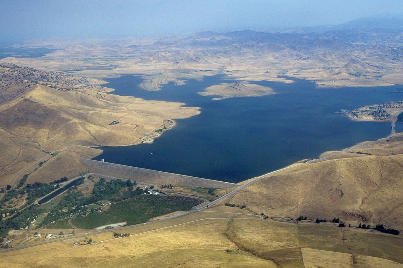
Photo: U.S. Army Corps of Engineers Sacramento District · Public domain
A signature stop locals and returning travelers point to in Porterville.
A signature stop locals and returning travelers point to in Porterville.
A signature stop locals and returning travelers point to in Porterville.
A signature stop locals and returning travelers point to in Porterville.
A signature stop locals and returning travelers point to in Porterville.
A signature stop locals and returning travelers point to in Porterville.
A pocket of Porterville with its own temperament — worth a deliberate detour when you're in the area.
A pocket of Porterville with its own temperament — worth a deliberate detour when you're in the area.
A pocket of Porterville with its own temperament — worth a deliberate detour when you're in the area.
A pocket of Porterville with its own temperament — worth a deliberate detour when you're in the area.
Wanderlust Pro
Pro members see insider tips for Porterville: a short list of restaurants, cafés and sights, picked by AI as local suggestions to double-check before you go.
The quick answers travelers want before they commit to flights, neighborhoods, and how long to stay.
Porterville has no commercial airline service of its own. The closest regional airport is Visalia Municipal Airport (VIS), approximately 36 miles north, while Fresno Yosemite International Airport (FAT) is about 75 miles away and offers more flight options. By car, Porterville sits on State Route 65 (connecting south to Bakersfield, ~50 miles) and State Route 190 (heading east into Sequoia National Forest). There is no direct Amtrak service; the nearest Amtrak station is in Hanford or Bakersfield, from which regional bus connections can be arranged. Tulare County Area Transit (TCAT) and Porterville Transit offer limited intercity connections to surrounding valley cities.
A personal vehicle is by far the most practical way to get around Porterville and access nearby attractions like Lake Success and Sequoia National Forest. For those without a car, Porterville Transit operates six fixed bus routes operating out of a centrally located Transit Center downtown, with the TripShot app providing real-time tracking. The city also offers transPORT, an on-demand microtransit service similar to Lyft — bookable via a dedicated mobile app — that provides curb-to-curb rides within the Porterville zone, including wheelchair-accessible vehicles. Passes can be purchased on the bus or at the Transit Center.
Spring (March through May) is arguably the best time to visit Porterville. Temperatures are mild, wildflowers bloom across the Sierra Nevada foothills, and the city comes alive with its signature Spring Festival (formerly the Iris Festival) in late April, which draws over 20,000 visitors to Main Street for live music, cooking competitions, and 100+ local vendors. Fall (September–November) is a close second, offering cooler weather and stunning autumn foliage that makes the mountain drives into Sequoia National Forest particularly scenic — ideal for camping and hiking. Summer can be intensely hot (the climate is characterized by hot, dry summers), so plan any outdoor activities for early mornings or late afternoons during July and August. Winter is mild by mountain standards — Porterville sits at around 500 feet elevation and often basks in sunshine while the lower San Joaquin Valley is socked in with tule fog — though roads into higher elevations may require chains.
Start with coffee at The Mud House on Main Street, then take a self-guided walking tour of Downtown's vibrant murals and Victorian-era architecture.
Visit the Porterville Historical Museum (housed in a former 1900s train depot) and the nearby Zalud House — an 1891 Victorian home with original furnishings and guided tours. Browse boutiques and antique shops along Main Street.
Dinner at a local Main Street restaurant, then catch a live performance at the Barn Theater — California's longest-running community theater.
Head east to Lake Success (10 minutes from downtown) for a morning of kayaking, boating, or fishing on the reservoir.
Picnic on the lakeshore, then explore Bartlett Park's hiking trails and disc golf course back in town, or tee off at the River Island Country Club nestled between Porterville and Springville.
Try your luck at Eagle Mountain Casino (owned by the Tule River Tribe), which features over 1,000 slot machines, table games, and on-site dining and live entertainment.
Drive east on Highway 190 into Sequoia National Forest. Walk the awe-inspiring Trail of 100 Giants — a flat, accessible loop through an old-growth grove of giant sequoias.
Continue deeper into the forest for a scenic hike with views of the Great Western Divide, or stop in the mountain community of Springville for lunch before heading back.
Return to Porterville for a relaxed dinner at one of the downtown eateries; end the night with a visit to McDermont Field House for arcade games or the skate park if traveling with family.
Real coworking spaces, laptop-friendly cafés, and libraries mapped near the center of the city — the closest, best-rated desks first.
No coworking-ready spots surfaced for this city yet.
Pick a different category or check back once we’ve indexed more desks for this city.
Ask for cafés, quiet neighborhoods, date-night spots, or a first 48-hour plan.
Mention calls, Wi-Fi needs, or how much of the day has to stay laptop-friendly.
Get faster answers on where to stay, when to move neighborhoods, and what to skip.
There aren’t any, yet!
Block off the weeks you're free. Wanderlust turns this dossier — flights, lodging, neighborhoods, timing — into a single draft itinerary in about ninety seconds.
Wanderlust Pro
Insider tips for Porterville, unlimited AI-built itineraries, and travel companions you can invite to plan a trip together. From $5.00/month, billed annually.
Wanderlust Pro
Pro members see insider tips for Porterville: a short list of restaurants, cafés and sights, picked by AI as local suggestions to double-check before you go.