Top sight
Top sight
A high-desert outdoor paradise where world-class skiing, epic trails, and 30+ craft breweries share one sun-drenched mountain town.
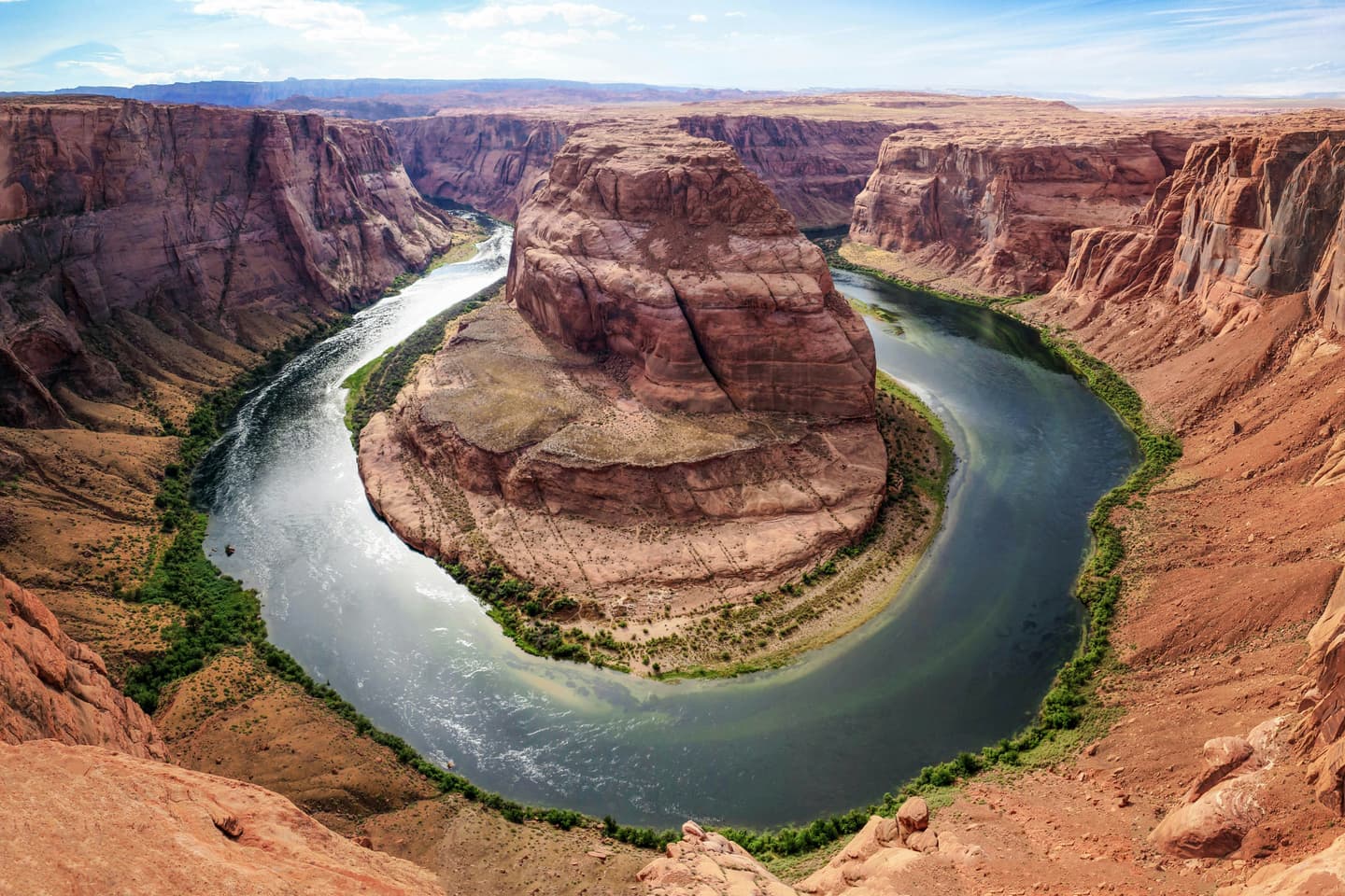
Bend is a vibrant high-desert city in central Oregon, nestled at 3,623 feet in the shadow of the Cascades with the Deschutes River running through its heart. Famous for world-class recreation at Mt. Bachelor and Smith Rock, it draws adventurers, remote workers, and foodies alike. With over 290 sunny days a year, 30-plus craft breweries, award-winning restaurants, and a buzzing arts and events scene, Bend packs big-city culture into an irresistible small-town soul. Rapid growth has elevated costs, but the quality of life and outdoor access remain genuinely exceptional.
More cities for these months: Where to go in June · Where to go in July · Where to go in August · Where to go in September · Where to go in October · Where to go in December
Insider tips · Wanderlust Pro
Practical tips on the sights and neighbourhoods in this Bendguide — when to go, what most visitors miss. Written with AI about the guide's own places; double-check details before you go. Pro members see every tip.
The quick answers travelers want before they commit to flights, neighborhoods, and how long to stay.
The closest gateway is Redmond Municipal Airport (RDM), just 17 miles north of Bend — about a 20-minute drive via Highway 97. Several major airlines offer direct daily service to RDM from West Coast hubs including San Francisco, Los Angeles, Seattle, and Portland. Car rentals are available at the airport; Uber and Lyft also serve the Central Oregon region. If you prefer to fly into Portland International Airport (PDX), expect a roughly 3.5-hour drive south on US-26 or US-20. Bus travelers can use Central Oregon Breeze for scheduled daily service between Portland and Bend, or Greyhound for connections to Portland, Eugene, and beyond. Amtrak's Coast Starlight stops in nearby Chemult; from there, an Amtrak Thruway bus connects to Bend in about 90 minutes.
A car is the most practical way to explore Bend and its surrounding trails, lakes, and mountains — the city is spread out and driving culture is deeply embedded. That said, car-free options are expanding. Cascades East Transit (CET) operates nine fixed bus routes across the city, Monday–Saturday, with plans to expand hours and routes through 2025–2026. Download the Transit App to track real-time arrivals and snow-schedule alerts in winter. For skiers, CET partners with Mt. Bachelor to run a dedicated ski bus from the SW Columbia Street Park-N-Ride; tickets cost $7 one-way or $10 round-trip via the Umo app. Uber and Lyft operate reliably throughout Bend, Redmond, and Sunriver. Bike share is available through the Veo app — pick up, ride, and drop at any designated station. The city is actively adding protected bike lanes and pedestrian crossings; over half of daily trips in Deschutes County are under 3 miles, making cycling a growing option for short trips.
Bend earns its reputation as a year-round destination, but each season has a distinct personality. Summer (June–August) is peak season: warm highs in the 80s°F, barely half an inch of rain per month, long daylight hours, and a packed calendar of river floats, outdoor concerts at Hayden Homes Amphitheater, and festivals. Book accommodation well in advance — especially around the Fourth of July — and be aware that wildfire smoke can push August air quality into unhealthy ranges; June and early July tend to offer the clearest skies. Winter (December–April) brings excellent skiing and snowboarding at Mt. Bachelor, which averages around 370 inches of snowfall annually and typically runs lifts from Thanksgiving through late May. Shoulder seasons are increasingly popular. Fall (September–October) is arguably Bend's best-kept secret: highs still averaging 65°F in September, dramatically fewer crowds, lower accommodation rates, and a rich calendar including the BendFilm Festival, Bend Fall Festival, and Oktoberfest. Spring (April–May) offers wildflower blooms, rushing Tumalo Falls, and a rare window to ski in the morning and hike at lower elevation in the afternoon.
Grab coffee at a local roaster on Wall Street, then walk Drake Park along Mirror Pond to get your bearings. Head to the downtown Bend Visitor Center for a Bend Ale Trail map.
Float the Deschutes River's classic two-mile route through the city — tube and boat rentals are available, and the summer shuttle ($5) returns you to Riverfront Park. Life jacket rentals are free.
Explore the Bend Ale Trail through the Old Mill District and downtown, sampling beers at a few of the city's 30-plus breweries. Catch a live show at Hayden Homes Amphitheater if the schedule aligns.
Drive 30 minutes north to Smith Rock State Park. Hike the Misery Ridge loop for towering red cliffs and canyon walls — arrive early to watch rock climbers in the golden morning light.
Return to Bend and visit the High Desert Museum, set in a ponderosa pine forest between Bend and Sunriver, for immersive exhibits on Central Oregon history and wildlife.
Dine at one of Bend's acclaimed westside restaurants. Stroll the Old Mill District's riverfront shops and catch the sunset over the Cascades.
Head 22 miles southwest to Mt. Bachelor — ski or snowboard in winter, or take the lift for mountain biking, scenic rides, and zip-lining in summer. The ski season typically runs Thanksgiving through late May.
Drive the Cascade Lakes Scenic Byway (open ahead of schedule in 2025 due to mild winter). Stop at Sparks Lake, Devils Lake, and Elk Lake for photos of volcanic peaks and hidden beaches.
Return to Bend for a well-earned dinner at a downtown craft restaurant, or check out the Saturday Farmers Market at The Grove for local produce, live music, and legendary pies.
Real coworking spaces, laptop-friendly cafés, and libraries mapped near the center of the city — the closest, best-rated desks first.
No coworking-ready spots surfaced for this city yet.
Pick a different category or check back once we’ve indexed more desks for this city.
Ask for cafés, quiet neighborhoods, date-night spots, or a first 48-hour plan.
Mention calls, Wi-Fi needs, or how much of the day has to stay laptop-friendly.
Get faster answers on where to stay, when to move neighborhoods, and what to skip.
Written by signed-in Wanderlust members. We don't check that a reviewer has visited.
No reviews of Bend yet.
Tell the planner your dates, who's coming, your budget and pace, and it drafts a day-by-day itinerary you can edit.
Wanderlust Pro
Insider tips for Bend, unlimited AI-built itineraries, and travel companions you can invite to plan a trip together. From $5.00/month, billed annually.
Insider tips · Wanderlust Pro
Practical tips on the sights and neighbourhoods in this Bendguide — when to go, what most visitors miss. Written with AI about the guide's own places; double-check details before you go. Pro members see every tip.